
Denver to Colorado Springs, Colorado
The Journey Takes About An Hour and 20 Minutes by Car and You Can Go Two Ways, Down I-25 or Along the Backroad Named Highway 83
How Far is It? About 70 Miles
If you want to feel like a pioneer coming across the prairie to Colorado in the 1800s, then take the drive from Denver to Colorado Springs. It is a pretty journey, with blue skies and wispy clouds above and wide open prairie with bluffs and buttes in the distance (if you want a breathtaking mountain excursion, then take the Denver to Glenwood Springs drive).
The I-25 Route
And if you are traveling along I-25, the major north-south interstate that runs from Las Cruces, New Mexico to Buffalo, Wyoming, then you will see lots and lots of cars on the road, all going way over the speed limit, which is 75 miles per hour. For whatever reason, this stretch of highway makes ordinary drivers turn into Mario Andretti.
And during the mornings and evenings, the traffic is nearly bumper to bumper, all going 90 miles per hour. People just seem to be in a huge rush to get to Colorado Springs, but, really, who can blame them?
So, aside from the traffic, what is the journey like? Well, it depends on where you start. If you begin north of Denver, say in Westminster or Thornton, then you will be driving on three or four lanes of a busy city highway. Coming down toward Denver, though, you'll catch some beautiful views of the city with the mountains to the west.
Denver drivers are like drivers most anywhere else. They speed, tailgate and change lanes without signaling. So it's a good idea to stay alert and remain as calm as you can because your patience will be tested, no matter what time of day it is.

As you stay on I-25, you'll pass through an area called The Mousetrap, where I-70 intersects with I-25, and you'll pass by the Denver Broncos stadium, the Children's Museum, trendy lofts and apartments and other city staples. Once you reach the Denver Tech Center down around Belleview Avenue and Orchard Avenue, then you are essentially on the south side of the city. Open road awaits.
As you finally leave Denver behind, you'll come up to a slight hill and then down around a curve towards a town called Castle Rock, so named because of the huge, castle-like rock that sits on a bluff next to town.
This stretch of highway offers some gorgeous views of not only Castle Rock but of the surrounding open prairie. In the summer, the land is green, and cows graze in far off pastures. This is where Pikes Peak begins to make a noticeable appearance in the distance.
You might also see a cargo locomotive with a long line of railcars often chugging along just west of the highway. When it blows its horn and its black smoke billows up against a backdrop of purple Rocky Mountains and blue sky, you might think the year is 1890.
After Castle Rock, which is a pretty town with master-planned communities and a huge outlet shopping mall next to the highway, you'll continue on through a landscape of closer-in bluffs, pine tree stands and hills to the west.
Soon you'll come up to the Larkspur exit, a town that hosts the annual Renaissance Festival every year. This is also a very scenic spot.
A few miles beyond Larkspur, you'll start to climb a hill up to a town called Monument, which is very nice once you get off I-25 and go west. From the highway, though, the area is peppered with gas stations and fast food outlets.
It is also 7,136 feet above sea level, and even though it doesn't look like it to the untrained (tourist) eye, this patch of I-25 is one of the most treacherous in all of Colorado. During winter snow storms, the wind comes howling down from the Rockies and creates whiteout blizzard conditions. It is an area that strikes fear in even the most experienced winter drivers.
To the east of Monument is a very nice area called Black Forest. As the name suggests, it is a thick pine grove and peppered with expensive homes. It can also disappear when the winter storms come.
Past Monument, the land flattens out and you'll see signs for some other housing developments. Then the exit for the Air Force Academy comes up on the right. Soon after that, the highway curves to the west, and the mountains come much closer. Pikes Peak looms to the south, and the pretty city of Colorado Springs starts to appear.
Traffic becomes more congested; houses and commercial buildings spring into view. Before you know it, you are in the midst of the hustle and bustle of Colorado Springs, the city also known as Little London.
The Highway 83 Route
People who travel beautiful Highway 83, the backroad to the east of I-25 between Denver and Colorado Springs, usually take a moment to utter a little prayer, "Pray for Me. I'm on 83," before setting out.
This is because even though this is only a two lane road, drivers still zoom along it as if it were the Indy 500. They tailgate, pass when large trucks are coming at them in the opposing lane and generally risk life and limb, all just to get to Colorado Springs. But again, who can blame them?
The good news is that this road carries much less traffic than Interstate 25. This is partly because not as many people know about it and because it is congested on the northern end as you drive through a town called Parker (Parker Road becomes Highway 83), and it is congested on the southern end as you enter Colorado Springs.
This can slow you down, making this the road not to take if you are interested in making time. Highway 83 is really best for people more interested in scenery than in getting to an appointment as scheduled.
This really is a lovely drive, particularly in the summer when the gently rolling land is a patchwork of greens and yellows. Nothing much is along this stretch except the entrance to Castlewood Canyon State Park, an unassuming park with red rocks, culverts and an old dam that burst in 1933. Few people know about the park but it is a pretty spot for a hike or picnic.
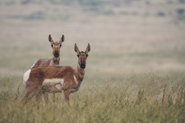
As you keep driving south to Colorado Springs you might see some antelope off in the distance, as well as cows and grazing horses. A cowboy on horseback might even appear once in a while.
You'll know you're close to Colorado Springs when Highway 83 becomes North Powers and commercial buildings start to pop up on either side of the road. Soon you'll be on the east side of the city, where the mountain views are just as gorgeous as they are when you arrive via I-25.
Go west and south and you'll find Garden of the Gods, Manitou Springs, Fort Carson, the Broadmoor and much, much more.
The End of the Road
So whichever way you travel from Denver to Colorado Springs, either via I-25 or 83, you'll have a pretty trip. Take it slowly and enjoy it (especially take it slowly in the winter). Both journeys are about an hour and 20 minutes, depending on traffic. Greyhound has a bus that makes the trip, but there is no train and no plans for a train anytime soon.
Colorado Journeys | Copyright (c) 2002-2022. All rights reserved.
Home | Privacy Policy | Cookie Policy | Terms and Conditions